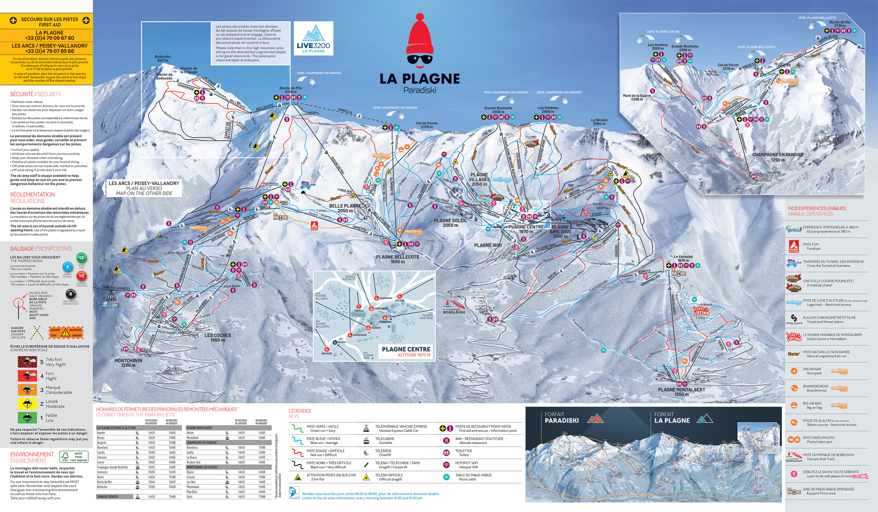
La Plagne Altitude
Top of pistes: 3,250 m
Bottom of pistes: 1,250 m

Prices
Day (adult): 61€
Weekly rate: 304€

Snowfall
Glacier: 200 cm
Station: 30 cm
Discover the entire ski area of the La Plagne ski resort
Top of pistes: 3,250 m
Bottom of pistes: 1,250 m
Day (adult): 61€
Weekly rate: 304€
Glacier: 200 cm
Station: 30 cm
La Plagne and neighbouring Les Arcs make up the extensive Paradiski area, linked by the speedy Vanoise Express gondola. With a fast and efficient lift system, comparable to those in larger resorts, you can quickly access a large ski area without too much queuing.
The resort has 225km of its own pistes, most of which are wide and gentle. The rest of the Paradiski area is also great for intermediate skiers, although there are plenty of red and black runs, as well as steep, off piste descents for advanced skiers.
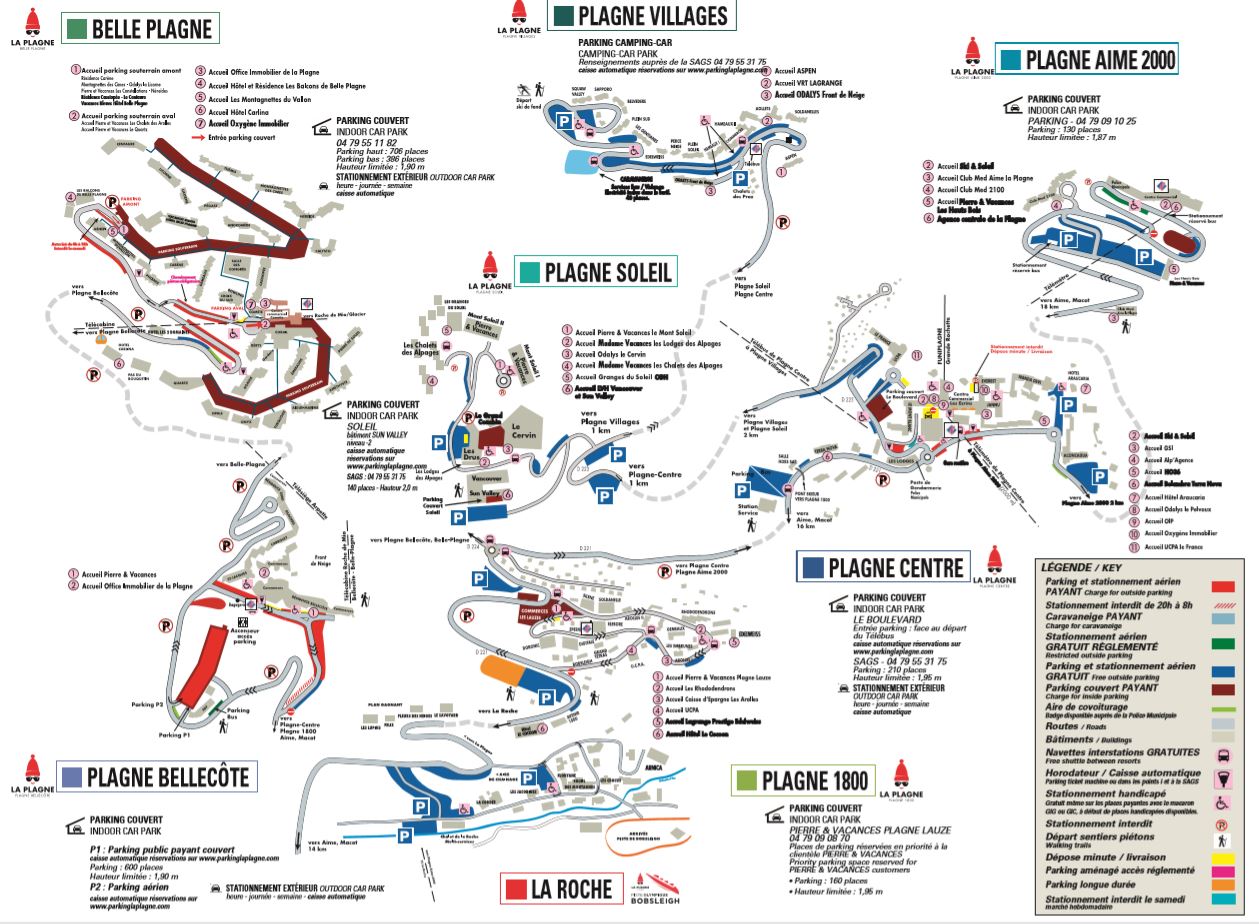
La Plagne is made up of 11 smaller villages, scattered across a plateau alongside a mountain - they vary from traditional farming villages such as Champagny en Vanoise, La Plagne Montalbert and Montchavin to purpose-built ski resorts such as Plagne Centre (the hub of the resort), Plagne Soleil, Plagne Aime 2000 and Belle Plagne. The different characters of each village makes it easy to choose an area that suits you - head to Plagne Centre or Belle Plagne for nightlife and apres-ski, or if you’re looking to relax at the end of a busy day on the slopes, quieter areas such as Montalbert, might suit you better.
The ‘village’ feel of the resort has made it a popular choice for families, who are well catered for and many of the village centres are car-free. Discover the different villages in the map below.