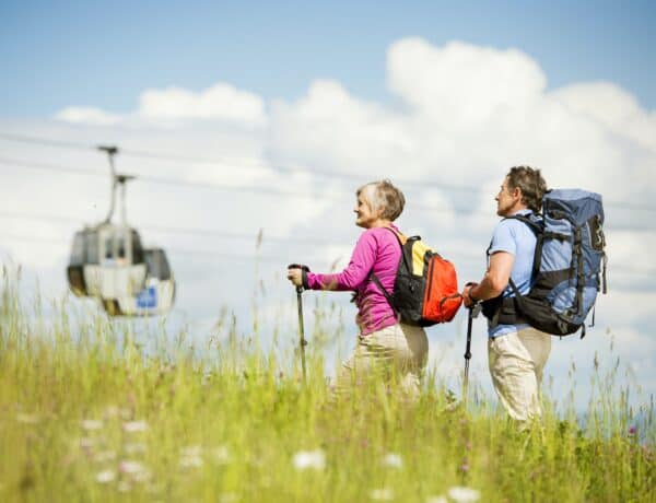
As winter loosens its grip, Montriond emerges from its chilly slumber, offering a fresh perspective for outdoor enthusiasts. In this post, we’ll guide you through a curated selection of 7 trails that capture the essence of the season.
From leisurely strolls along flower-lined paths to more challenging routes revealing panoramic mountain vistas, these hikes showcase the natural beauty that blossoms around this idyllic alpine location during the spring months. Plus, the Portes du Soleil region is home to some great gentle hikes which are ideal for families of novice hikers. So lace up your hiking boots and join us as we navigate through the rejuvenating landscapes of Montriond!
Visit Montriond in spring
The top spring hikes around Montriond
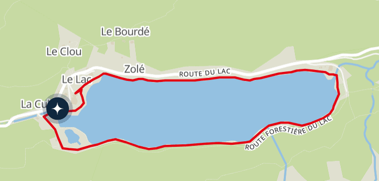
1. Lac de Montriond interpretation trail
Distance: 3km
Duration: 45min
Elevation gain: 60m
Lake Montriond is the perfect place to take a breath of fresh air beneath the silhouette of the mountains. It is one of the 20 must-see places in the Chablais UNESCO Global Geopark. It takes just under an hour to complete a lap around the lake, on a pushchair-friendly path.
An entire geological and historic world is hidden around this charming lake. A reading table and information panels along the trail tell you all about the glacial history of the valley, the formation of the lake and the story of the Baron de l’Espée.
A perfect place to stroll and recharge your batteries, taking time to contemplate life…
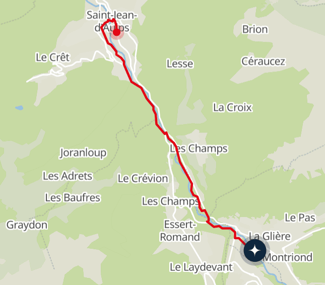
2. The banks of the Dranse
Distance: 6km
Duration: 1h 30min (one way)
Elevation gain: 100m
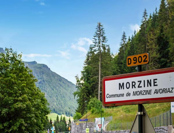
This walk takes you from the centre of Montriond to the village of Saint-Jean-d’Aulps, following the flow of the Dranse de Morzine. The path is relatively flat and laid out in the shade of the undergrowth. It is therefore accessible to all, including pets on a lead.
Once you arrive at Saint-Jean-d’Aulps, don’t forget to pay a visit to the neo-gothic church, home to the relic of Saint-Guérin.
You can return on the same path you came, or on the Balad’Aulps Bus, which stops in front of the Montriond tourist information centre.
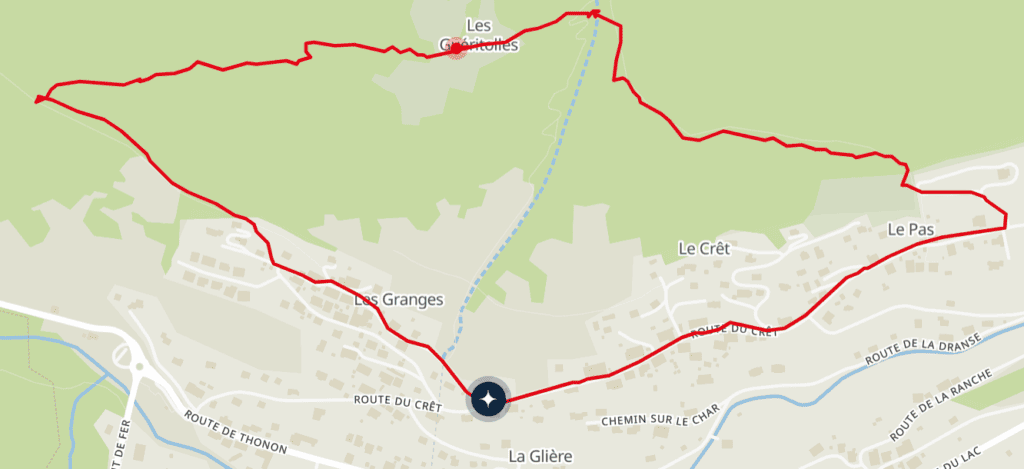
3. Les Guéritolles
Distance: 3.4km
Duration: 1h 30m
Elevation gain: 243m
This forest trail takes you up to discover the resort’s highest points via Les Guéritolles, a small rural village frozen in time. The village boasts a breathtaking panoramic view that stretches as far as Morzine and Essert-Romand.
Along the way, you will come across authentic alpine chalets and traditional grain stores, evidence of the prominent role agriculture plays in the area’s history. You will cross several fields occupied by entirely unperturbed cows.
The walk begins at the Granges car park. Parking is free if you wish to leave a vehicle, or you can take advantage of the shuttle bus.
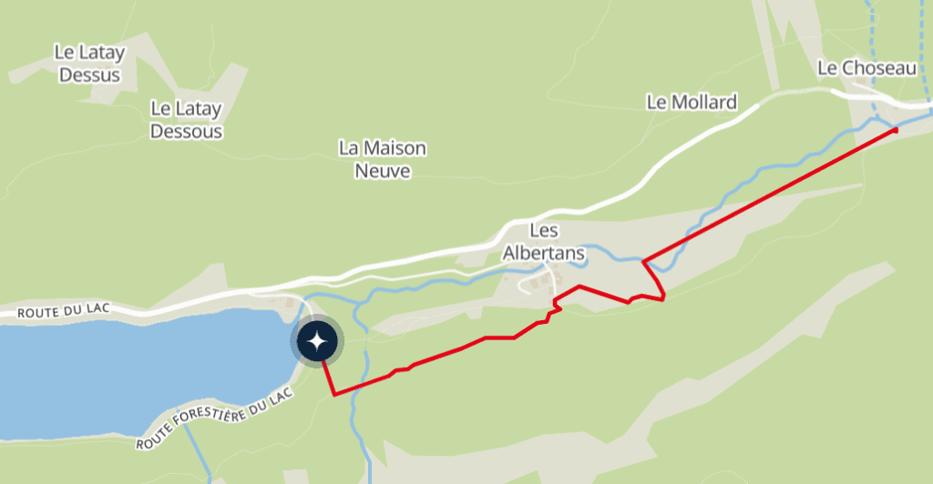
4. Ardent waterfall from Lake Montriond
Distance: 1.9km
Duration: 2h (return trip)
Elevation gain: 129m
This walk is ideal for prolonging the tour of the lake (see hike no. 1), for a day dedicated to the waters of the Alps. You will leave from the shores of Lake Montriond and arrive at the listed site of the Ardent waterfall (Cascade d’Ardent), surrounded by forest. A footbridge gives you a view from above, allowing you to appreciate it in all its magnificence.
The trail alternates between clearing and forest and passes very close to the traditional chalets of the hamlet of Albertans. Along the way, you can see the cliffs on the right, which were used for slate production until the 1950s.
Return by the same route or by taking the free shuttle bus back to the resort.
Experience spring in Portes du Soleil
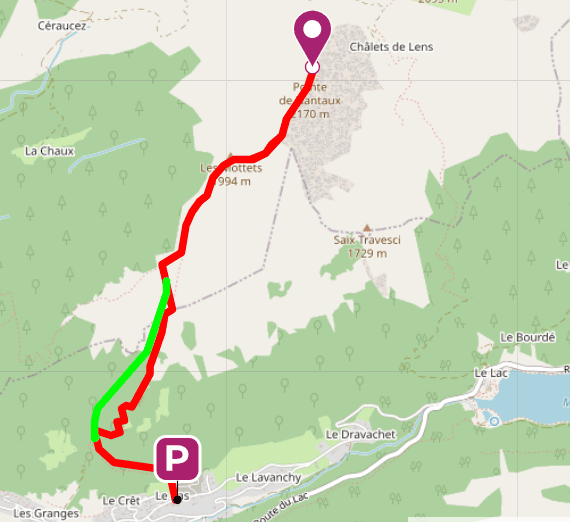
5. Pointe de Nantaux
Distance: 7.1km
Duration: 5h (return trip)
Elevation gain: 1,220m
The ridge route to the summit of the Pointe de Nantaux, at 2,170m, is not particularly technical, but it does require a sustained effort. This hike is therefore recommended for walkers looking for a physical challenge.
After passing through a forest and crossing a stream on a wooden footbridge, the path becomes steep. But once you’ve reached the summit, you’ll be able to catch your breath while you admire the Chablais peaks all around you.
This route starts right in the centre of the resort, or you can park your car in the hamlet of Le Pas. Note that the green line on the map below indicates a more direct but steeper variant.
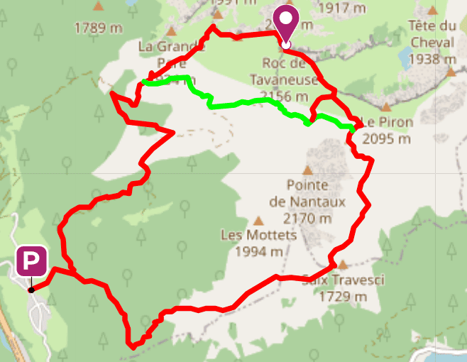
6. Roc de Tavaneuse
Distance: 11.9km
Duration: 6h
Elevation gain: 1,250m
The beauty of this route is in the variety of landscapes it passes through and the terrain it covers. It explores the various slopes of the Pointe de Nantaux, with a diversion to the summit of the Roc de Tavaneuse, at 2,156m altitude.
Previous hiking experience is required to tackle certain off-trail sections or get around dead trees. But your efforts are rewarded by an enchanting setting from start to finish, overlooking the whole of the Chablais and the Haut-Giffre ranges, with Mont Blanc on the horizon.
The green line on the map below indicates a shortcut that avoids the ascent of Roc de Tavaneuse. Allow 2 hours less for this alternative route.
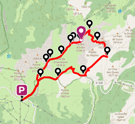
7. Le Roc d’Enfer (Hell’s Rock)
Distance: 14km
Duration: 6h 30min
Elevation gain: 890m
This long route is as sublime as it is dizzying. As it explores the Chablais range, it reaches the Col du Foron, the Roc d’Enfer at 2,243m, the Brêche de la Golette and the Col du Rati.
After a peaceful start in front of the Foron alpine chalets, the path becomes a ridge path, then continues jaggedly over the ridge chain. You will have to choose several times between following the line of the ridge and crossing the mountainside.
Beware: you will often be exposed to the void, on terrain that can be slippery from rain or snow residue. This route must only be tackled in dry weather, with good quality walking shoes and by walkers with plenty of hiking experience.
Finally, be the first to hear about our beautiful new properties and exclusive offers by subscribing to our newsletter.