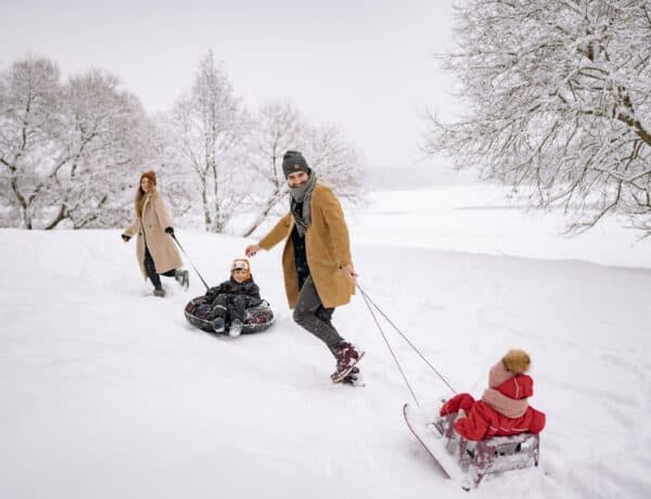
As winter loosens its grip, Praz-de-Fort emerges from its chilly slumber, offering a fresh perspective for outdoor enthusiasts. In this post, we’ll guide you through a curated selection of 7 trails that capture the essence of the season.
From leisurely strolls along flower-lined paths to more challenging routes revealing panoramic mountain vistas, these hikes showcase the natural beauty that blossoms around this idyllic alpine location during the spring months. Plus, the region is home to some great gentle hikes which are ideal for families of novice hikers. So lace up your hiking boots and join us as we navigate through the rejuvenating landscapes of Praz-de-Fort!
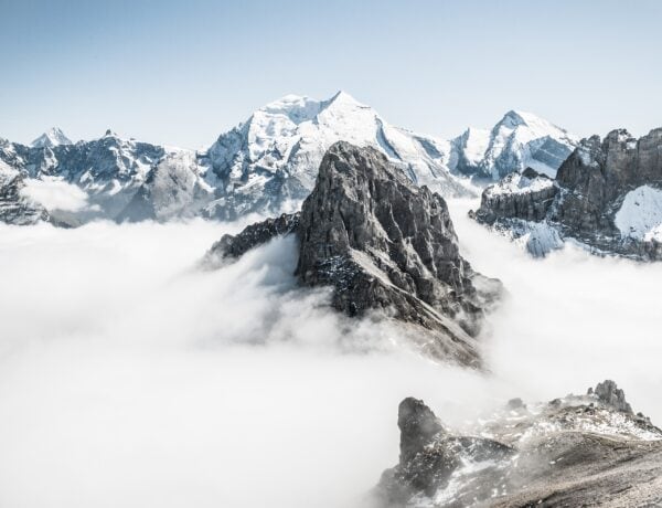
Visit Praz-de-Fort in spring
The top spring hikes around Praz-de-Fort
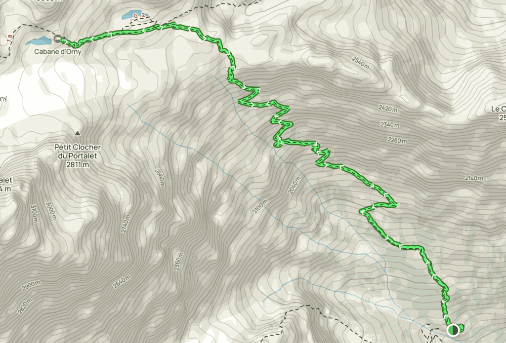
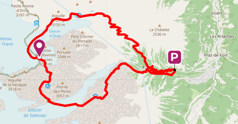
1. Cabane d’Orny via Saleinaz
Distance: 10.6km
Elevation gain: 1258m
Hiking in the canton of Valais is often technical, and this route is proof of that. With over 1,000m of elevation gain from the starting point, it requires you to be in excellent physical shape. Some high-altitude stretches can be snow-covered, even in spring.
Your destination is a refuge at 2,826m altitude, just below the Orny glacier, overlooking a delightful mountain lake. This is a magical spot for a picnic, however, the refuge itself is only open during the summer months.
Allow a full day for the round trip, taking the time to make the most of the panoramic view of the Portalet, and Aiguille d’Argentière summits as well as the Trient glacier.
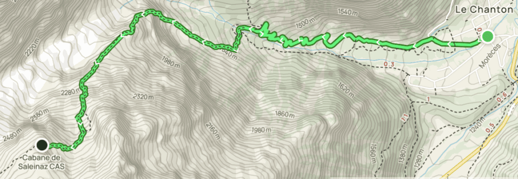
2. Saleinaz Hut
Distance: 6.4km
Duration: 4h 30m (return trip)
Elevation gain: 1,455m
This is a demanding hike to the Saleinaz hut, a mountain refuge in the Mont-Blanc range, at 2,691m altitude. In Switzerland, mountain refuges are called cabanes – huts.
After a winding ascent through the forest, along the Reuse de Saleinaz, you’ll cross the river and the moraine with the aid of chains and metal rungs. This technical section gives the hike a via ferrata feel.
Then it’s just a matter of negotiating an accumulation of rocks to reach the hut, with the Saleinaz glacier keeping you company for the last few metres. You can admire it from a viewpoint about 20m behind the shelter.
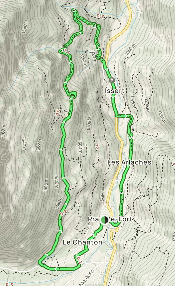
3. Loop from Praz-de-Fort to Issert
Distance: 8km
Duration: 3h
Elevation gain: 410m
This shorter, easier hike is a wonderful introduction to the Praz-de-Fort region. You will come across several natural and architectural treasures as you wind along forest trails and country roads.
From the centre of the resort, follow the banks of the Reuse de Saleinaz, then cross the Suplis forest, before reaching the commune of Issert. The Tour du Mont-Blanc trail leads up to the middle of the Champex ascent, before climbing through the woods. Enjoy breathtaking views of Mont Vélan and the Grand Combin, the second-highest peak in this part of Switzerland.
Your route ends at Le Chanton on the tarmac road, and then you can retire to the well-deserved comfort of your OVO Network chalet.
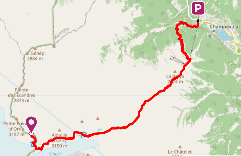
4. Pointe d’Orny (Champex-Lac)
Distance: 20km
Duration: 7-9h (return trip)
Elevation gain: 1,770m
Perched at an altitude of 3,269 m, the Pointe d’Orny reveals a panorama from another world: the glacial plateau of Trient, surrounded by the Aiguille du Tour, the Aiguille Purtscheller, the Grande and Petite Fourches, and the Aiguilles Dorées.
This high-mountain circuit winds its way through the forest, before reaching a point overlooking the Combe d’Orny at an altitude of 2,450 metres. After reaching the source of the Darbellay stream, the surreal green of the Lac d’Orny with its glacier follows, then a second glacial lake, spread out at the foot of the Cabane d’Orny.
At 3,170m, you’ll be greeted at the Cabane du Trient by Nikola Zaric’s phantasmagorical sculptures which seem to be keeping watch over the clouds. Return by the same route.
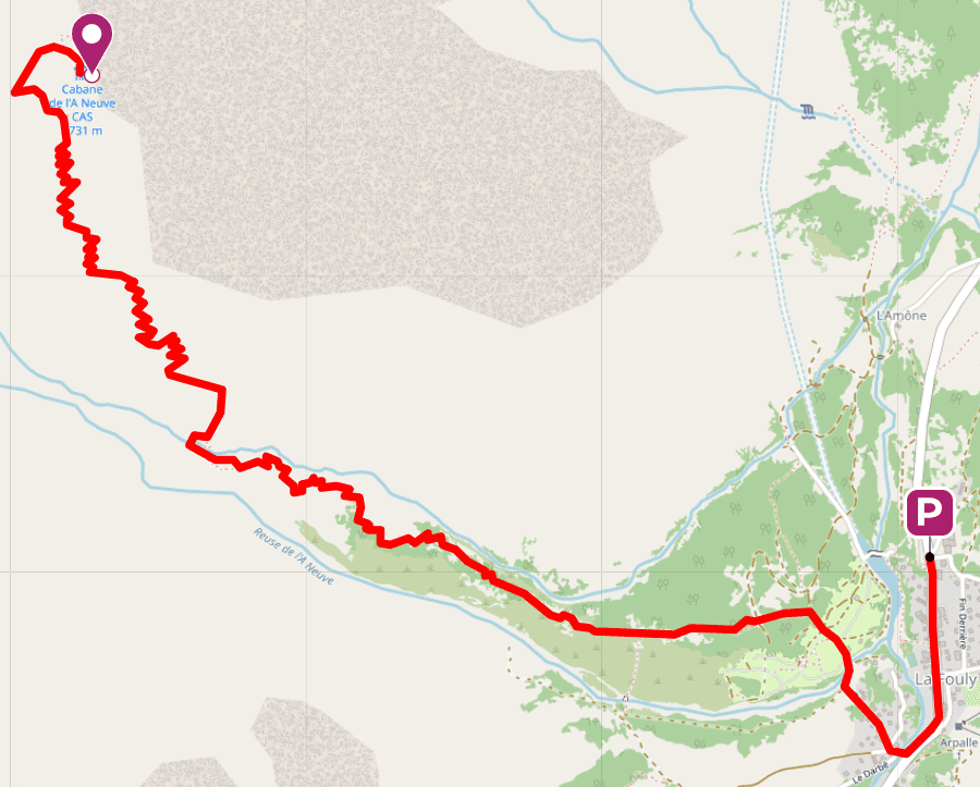
5. Cabane de l’A Neuve (La Fouly)
Distance: 11km
Duration: 6-7h (return trip)
Elevation gain: 1,145m
Hikes in the Praz-de-Fort region often follow rugged, high-altitude trails, revealing the beauty of the Alps in springtime. This is very much true of this trail, which begins in the hamlet of La Fouly, just 8km from the resort.
After passing through a coniferous forest, the path climbs gently between two reuses, the name given to mountain streams in this region. At 2,000m, you will cross a boulder to find yourself in a picturesque, bucolic setting of heather and wild blueberries.
The A Neuve hut awaits you at an altitude of 2,735m. Above you, the silhouette of Mont Dolent stands out against a chain of needle-like rocky protrusions.
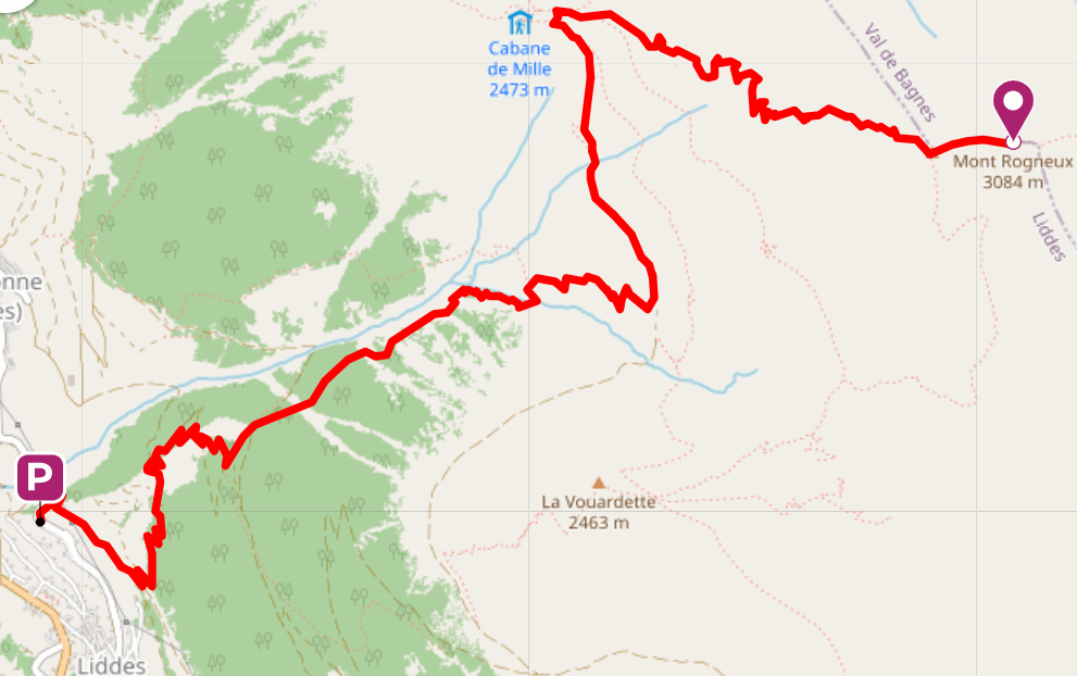
6. Mont Rogneux (Liddes)
Distance: 17km
Duration: 7-8h (return trip)
Elevation gain: 1,700m
This route to the summit of Mont Rogneux, which rises to 3,084m above sea level, passes through a variety of landscapes with a rural flavour. The perfectly marked trail leaves the forest and runs alongside the Aron mountain stream, before reaching the scattered ruins of several abandoned mountain hamlets.
The Col de Mille, at 2,471m, reveals a 360º panoramic view of Mont Brûlé, Catogne, the Grand Combin, the Aiguille d’Argentière and the summit of Mont Rogneux, your destination for the day.
The final section, however, is not easy to negotiate. You’ll have to use your hands to climb boulders that are slippery with snow residue, even at the height of spring.
7. Roc des Plines via the Saleinaz Valley
Distance: 18km
Duration: 12h
Elevation gain: 2,200m
This hike is without doubt the most demanding of this selection. Long and steep, with some off-trail sections, it requires previous hiking experience, excellent physical fitness, and good quality shoes with spikes.
The landscapes you’ll pass through will seem otherworldly. Climbing up a deep valley surrounded by needle-like granite protrusions, you’ll come to one of the wildest polar circuses in the Mont-Blanc range.
The view from the roc des Plines, at 3,293m, opens out onto the Aiguilles d’Argentière, Grande Fourche and Portalet, with the Ravines Rousses glacier on the horizon. It’s a setting that is awe-inspiring in its enormity, reminding hikers of their true place in the universe…
- The emergency numbers you need to know in the mountains
- Which animals can be found in the mountains in spring?
Finally, be the first to hear about our beautiful new properties and exclusive offers by subscribing to our newsletter.