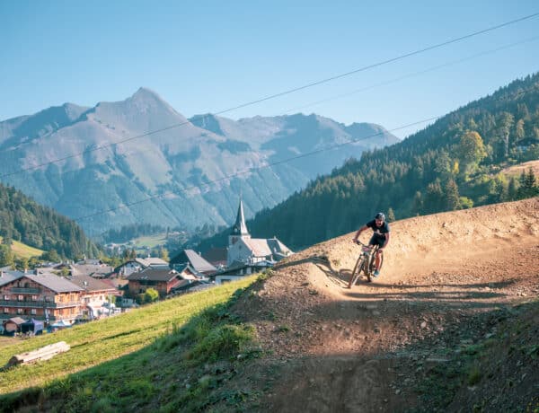
As winter loosens its grip, Châtel emerges from its chilly slumber, offering a fresh perspective for outdoor enthusiasts. In this post, we’ll guide you through a curated selection of 7 trails that capture the essence of the season.
From leisurely strolls along flower-lined paths to more challenging routes revealing panoramic mountain vistas, these hikes showcase the natural beauty that blossoms around this idyllic alpine location during the spring months. Plus, the Portes du Soleil region is home to some great gentle hikes which are ideal for families of novice hikers. So lace up your hiking boots and join us as we navigate through the rejuvenating landscapes of Châtel!
Visit the Portes du Soleil
The top spring hikes around Châtel
1. Morclan Trail
Distance: 3.5km
Duration: 2h 30m (one way)
Elevation gain: 200m
Climb the heights and admire the beauty of the countryside around Châtel. You’ll discover the “arc” of the Vallée d’Abondance and the Mont de Grange and learn more about the mountain’s animals and plants.
You will cross the forest on the mountainside to reach several mountain pastures, bedecked with multicoloured flowers. Before arriving at Super-Châtel, you’ll be able to observe numerous species of alpine fauna. It’s important to stay on the paths and keep dogs on a lead.
The return journey takes the same route, giving you the chance to enjoy some views you may have missed.
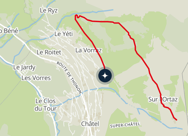
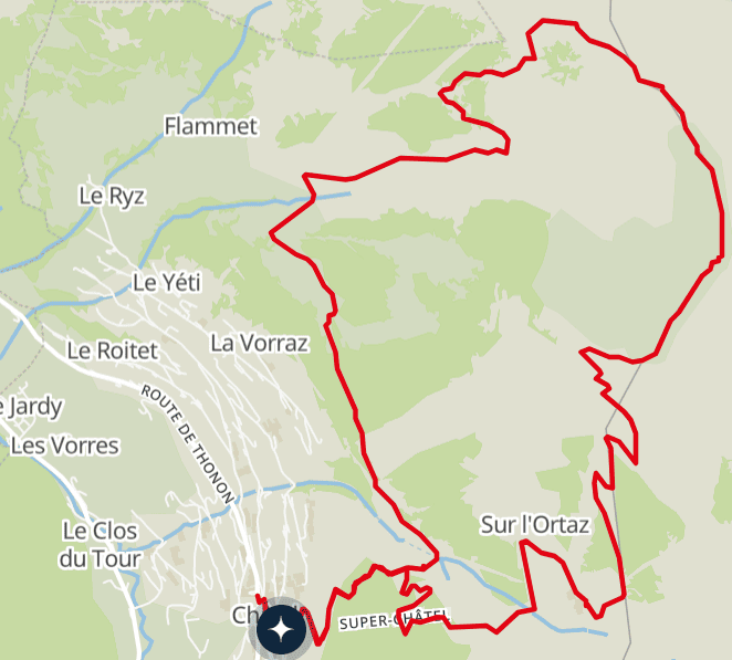
2. The Franco-Swiss Ridge Route
Distance: 12km
Duration: 5h 25m
Elevation gain: 903m
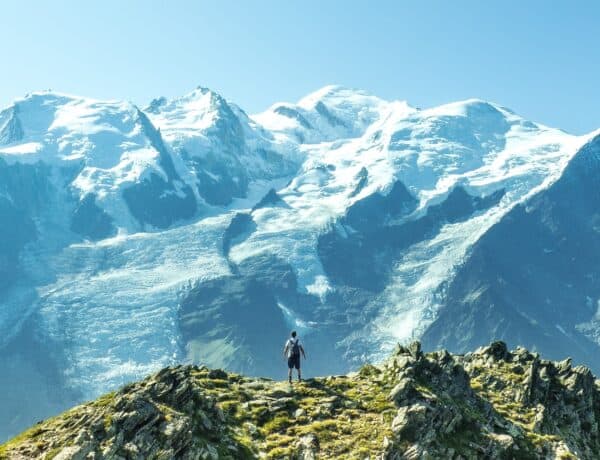
This is the must-do spring hike from Châtel. On a clear day, the panorama from the ridges takes in the whole of the Mont Blanc range and the main Swiss peaks. This area was once a hotbed of smuggling.
After passing through a spruce forest, you’ll reach the chalets of Conche and then climb the Pointe du Morclan to enjoy the first of a series of 360-degree views. This is followed by the Col de la Folière, the Pointe des Ombrieux and the mountain pastures of the Portes d’Onnaz.
Once you’ve had your fill of the panorama, head back down towards Le Boude to return to the village.
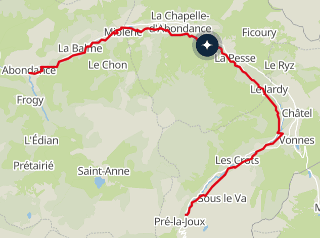
3. Bords de Dranse
Distance: 16km
Duration: 3h 30m – 4h (one way)
Elevation gain: flat
Here’s an easy, peaceful walk to enjoy with the whole family, along the River Dranse between Châtel and Abondance. You can go at your own pace, stopping off at the villages along the way.
The path is also very pleasant to cycle along, being relatively flat and accessible to pushchairs. This lets everyone appreciate the rich natural and cultural heritage of the Abondance Valley.
It is of course possible to cover only part of this route and then return on the “Columbus” shuttle. View the detailed map of the path.
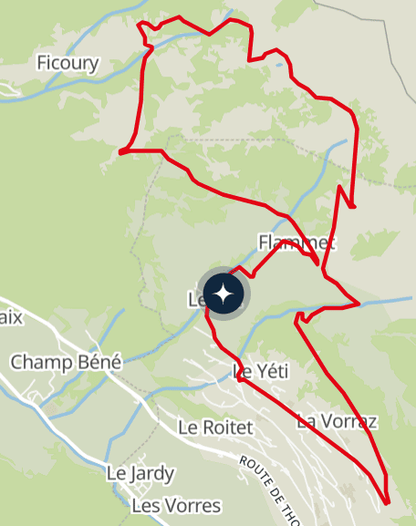
4. Mouet loop from Châtel
Distance: 8.2km
Duration: 3h
Elevation gain: 550m
It takes less than an hour from the heart of the resort to explore the rural landscape that makes the Alps so charming no matter the season.
This gentle family walk climbs to a higher altitude as you explore the heights of the village of Châtel. You will pass by several working farms, which are wonderful examples of local architecture, where the delicious Abondance cheese is still made in the traditional way.
As well as the cultural delights, you’ll also be coming face to face with some of the region’s natural riches. The path crosses alpine pastures and streams, leading to the Col du Saix where you can admire the magnificent panoramic view.
Experience spring in Châtel
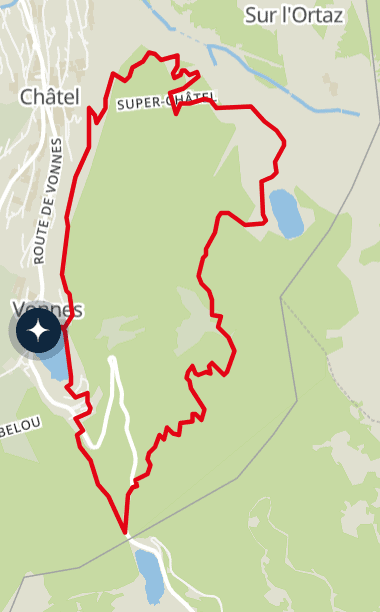
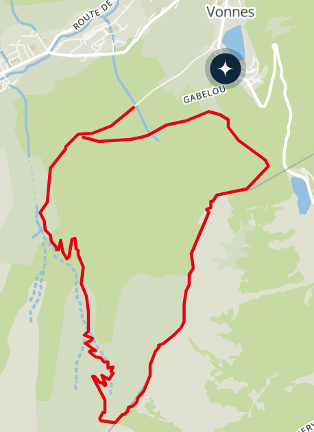
5. Boucle sur le Bord (Vonnes)
Distance: 6.9km
Duration: 3h 30m
Elevation gain: 438m
After walking along the shore of Lac de Vonnes, you can admire it from the heights of the Pas de Morgins. On the other side of the border, Lac de Morgins reflects the Swiss sky.
You will then pass through several spruce forests, an essential part of the subalpine environment. These woods are interspersed with plunging views of the upper Abondance valley, including Linga and the Essert waterfall.
The final part of the walk takes you to a third lake, the Lac de la Mouille, which is a splendid setting for a picnic. You will then continue downhill towards the Conche chalets to return to the village and the comfort of your OVO Network property.
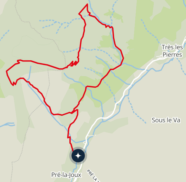
6. Betzalin Loop (Pré la Joux)
Distance: 8.3km
Duration: 3h 20m
Elevation gain: 567m
This route starts at Pré la Joux, 6km from Châtel. It takes you on an exploration of the different landscapes of the Mont-de-Grange reserve, a protected area for chamois, mouflons and marmots. With a bit of luck and a lot of patience, you’ll be able to spot some.
The first part of the path, along the stream to the Betzalin chalet, is fairly steep. Once you reach the mountain pasture, the path levels out a little and crosses the place known as “Sur-le-Crac”, which overlooks the Essert waterfall.
You’ll then enjoy a breathtaking view of the Mont-Blanc range, before heading into a small valley and then into a forest with the scent of spring in the air. At the end of the route, you return to the starting point via the same path you used at the start.
7. Pointe du Midi (Vonnes)
Distance: 8.4km
Duration: 4h
Elevation gain: 782m
Another not-to-be-missed hike from Châtel, this route passes through forests and alpine pastures before leading you up to the breathtaking panoramic view of the Pointe du Midi. The entire Abondance valley seems to be at your fingertips, while, on the other side, the peaks of Switzerland stretch out before you.
Following the natural border between the two countries, the descent is partly shaded by undergrowth where the “voraches”, the local name for the wild alder tree, flourish.
Take advantage of this outing to watch roe deer and chamois frolicking freely in the spring sunshine.
Finally, be the first to hear about our beautiful new properties and exclusive offers by subscribing to our newsletter.